QUESTIONS? CALL OR TEXT! 1 (877) 921-6277 or (403) 266-2241
WE SHIP EVERYWHERE!

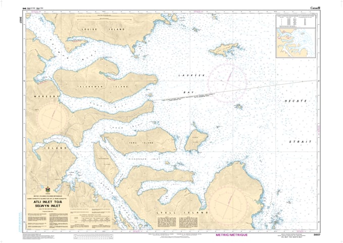
Navigate the dramatic eastern coastline of Moresby Island with the professional authority of the Canadian Hydrographic Service (CHS). Chart 3807 is the definitive 1:37,500 scale "road map" for mariners, providing the comprehensive coverage required for safe passage through the deep fjords and island-studded reaches of Atli Inlet, Selwyn Inlet, and the surrounding northern Gwaii Haanas region.
The waters of Haida Gwaii are known for their immense biological diversity and rugged geography. CHS Chart 3807 provides the "ground-truth" data required for safe pilotage in these secluded waters:
Selwyn Inlet & Atli Inlet Coverage: Features detailed bathymetry for these major inlets, which serve as critical destinations for eco-tourism, research vessels, and commercial fishing fleets.
Dana & Logan Inlets: Provides the resolution necessary to navigate the intricate channels of Dana Inlet and Logan Inlet, identifying safe leads through steep-walled coastal passages.
Reef and Hazard Identification: Explicitly marks the locations of submerged rocks, drying reefs, and kelp forests, ensuring situational awareness in the nutrient-rich, high-visibility waters of the Pacific.
Seafloor & Anchorage Intelligence: Shows precise water depths and the nature of the sea bottom (rock, sand, or mud), vital for selecting secure anchorages in remote bays like Pacofi Bay or Echo Harbour.
With the increasing development of ocean resources and the continued popularity of Haida Gwaii for recreational exploration, the reliability of Chart 3807 is more vital than ever. Specifically designed to meet the rigorous requirements of marine navigation, this official CHS chart delivers the accuracy and detail needed to explore the western edge of Hecate Strait with total confidence.
| Feature | Details |
| Chart Number | 3807 |
| Region | Pacific Coast (Haida Gwaii / Moresby Island) |
| Scale | 1:37,500 |
| Dimensions | 36" x 46" (Standard Paper Size) |
| Publisher | Canadian Hydrographic Service (CHS) |
| Key Coverage | Atli Inlet, Selwyn Inlet, Dana Inlet, Logan Inlet, Moresby Island |
| Compliance | Meets official carriage requirements for safe marine navigation |