QUESTIONS? CALL OR TEXT! 1 (877) 921-6277 or (403) 266-2241
WE SHIP EVERYWHERE!

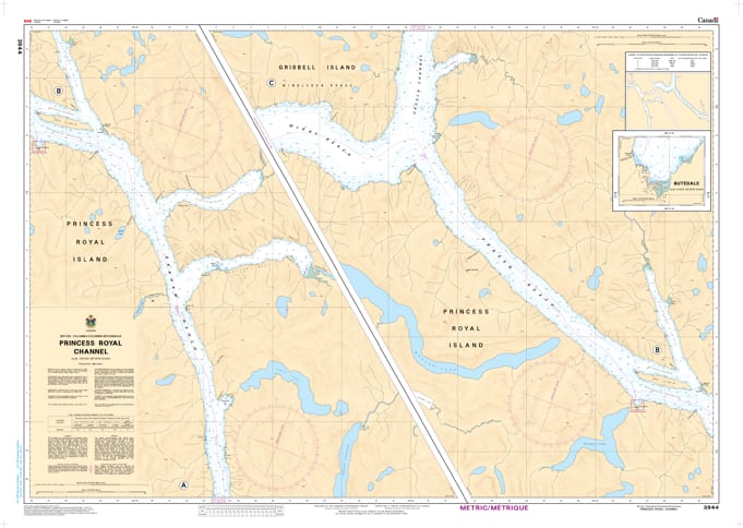
Navigate the majestic and narrow corridors of the British Columbia Mid-Coast with the professional authority of the Canadian Hydrographic Service (CHS). Chart 3944 is a specialized 1:40,000 scale navigational tool, providing the high-resolution "ground-truth" data required to safely traverse Princess Royal Channel, including the legendary stretches of Graham Reach and Fraser Reach.
Princess Royal Channel is a vital link in the Inside Passage, characterized by steep mountain walls and deep, glacial-carved waters. CHS Chart 3944 provides the specific intelligence needed for safe passage:
Graham & Fraser Reach Detail: Features high-resolution bathymetry for these deep, narrow arterial waterways, ensuring safe leads for large vessels and pocket cruisers alike.
Butedale & Historic Hubs: Provides precise mapping for the approaches to Butedale, a landmark stop for mariners seeking fresh water and a glimpse into the region's cannery history.
Khutze & Aaltanhash Inlets: Detailed data for the stunning branching fjords of Khutze Inlet and Aaltanhash Inlet, identifying safe anchorages and potential tidal hazards at river mouths.
Hazard & Landmark Identification: Explicitly marks submerged rocks, waterfalls, and navigational aids, providing essential situational awareness in a region where GPS signals can be shadowed by high terrain.
As the primary navigational resource for BC Ferries, tug and barge operations, and wilderness cruisers, the reliability of Chart 3944 is paramount. Specifically designed to meet the rigorous requirements of marine navigation, this official CHS chart delivers the accuracy and detail needed to explore the wilderness of Princess Royal Island with total confidence.
| Feature | Details |
| Chart Number | 3944 |
| Region | Pacific Coast (Central Coast BC / Princess Royal Island) |
| Scale | 1:40,000 |
| Dimensions | Approx. 36" x 45" (Standard Paper Size) |
| Publisher | Canadian Hydrographic Service (CHS) |
| Key Coverage | Princess Royal Channel, Graham Reach, Fraser Reach, Butedale, Khutze Inlet |
| Compliance | Meets official carriage requirements for safe marine navigation |