QUESTIONS? CALL OR TEXT! 1 (877) 921-6277 or (403) 266-2241
WE SHIP EVERYWHERE!

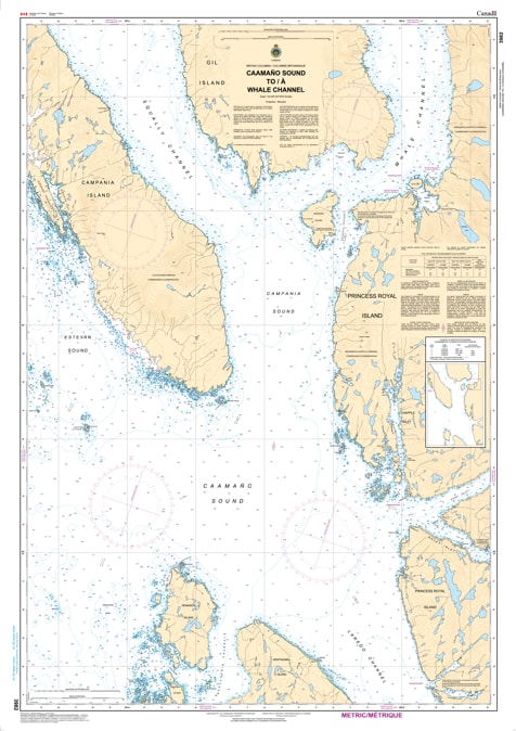
Navigate the most breathtaking and high-traffic reaches of the British Columbia Central Coast with the professional authority of the Canadian Hydrographic Service (CHS). Chart 3982 is the definitive 1:40,000 scale navigational guide for the convergence of Caamaño Sound and Whale Channel—a region world-renowned for its humpback whale populations and dramatic fjord scenery.
This chart covers the vital "bend" in the Inside Passage, where mariners must transition from the more exposed sound into the sheltered deep-water channels. CHS Chart 3982 provides the "ground-truth" data required for safe passage:
Whale Channel & Wright Sound: Features high-resolution bathymetry for the primary deep-water corridor used by cruise ships, BC Ferries, and commercial traffic heading toward Prince Rupert or Kitimat.
Gil Island & Campania Island Detail: Detailed mapping for the waters surrounding Gil Island (site of the Queen of the North incident) and the rugged shores of Campania Island, identifying safe leads through these complex passages.
Squally Channel & Otter Passage: Provides the strategic data required to navigate the technical entrances of Squally Channel and the high-current waters of Otter Passage.
Hazard & Light Intelligence: Explicitly marks the numerous drying reefs, isolated rocks, and essential navigational aids required for safe night transit and low-visibility conditions common in the Great Bear Rainforest.
As the primary navigational resource for professional pilots, eco-tour operators, and long-range cruisers, the reliability of Chart 3982 is paramount. Specifically designed to meet the rigorous requirements of marine navigation, this official CHS chart delivers the accuracy and detail needed to explore the Central Coast with total confidence.
| Feature | Details |
| Chart Number | 3982 |
| Region | Pacific Coast (Central Coast BC / Inside Passage) |
| Scale | 1:40,000 |
| Dimensions | Approx. 36" x 45" (Standard Paper Size) |
| Publisher | Canadian Hydrographic Service (CHS) |
| Key Coverage | Caamaño Sound, Whale Channel, Gil Island, Campania Island, Squally Channel |
| Compliance | Meets official carriage requirements for safe marine navigation |