QUESTIONS? CALL OR TEXT! 1 (877) 921-6277 or (403) 266-2241
WE SHIP EVERYWHERE!

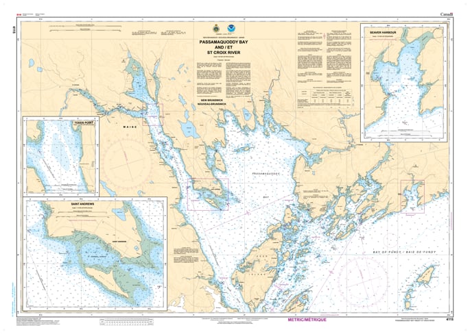
Navigate the scenic and high-energy waters of the North Atlantic border with the 4115 - Passamaquoddy Bay & St. Croix River Nautical Chart. This professional-grade hydrographic reference is the definitive guide for one of the most tidal-sensitive regions in the world. Covering the expansive reaches of Passamaquoddy Bay and the winding navigation of the St. Croix River, Chart 4115 provides the "ground-truth" data required to safely transit from the open Bay of Fundy to the inland ports of St. Stephen, New Brunswick, and Calais, Maine.
Produced to the rigorous standards of the Canadian Hydrographic Service (CHS), Chart 4115 delivers comprehensive information for this shared waterway:
St. Andrews & Deer Island: Features high-resolution mapping for the popular tourist and fishing hub of St. Andrews, as well as the technical channels surrounding Deer Island.
The Western Passage: Detailed bathymetry for the deep-water Western Passage, a critical route for commercial shipping and aquaculture operations.
St. Croix River Transit: Comprehensive soundings for the river corridor, including the international bridge clearances and current patterns essential for navigating up to St. Stephen and Calais.
Navigational Hazards: Clearly marks the legendary whirlpools (Old Sow), rocky ledges, and drying shoals that appear during the Bay of Fundy’s dramatic 20-foot+ tidal shifts.
Beyond the bridge, this chart serves as a sophisticated piece of maritime history and art for those with a connection to Charlotte County or Washington County.
Official Technical Aesthetic: Showcases the intricate line work, sounding density, and maritime symbols that define professional Canadian hydrography.
Vivid Print Quality: Printed with high-definition clarity to ensure every depth contour, buoy, and light characteristic is sharp and legible for study or display.
The Perfect Coastal Gift: An ideal memento for sailors, history buffs, or residents of the Fundy Isles who respect the power of the tides.
| Feature | Details |
| Chart Number | 4115 |
| Location | Passamaquoddy Bay / St. Croix River (NB / ME) |
| Scale | 1:50,000 |
| Key Areas | St. Andrews, Deer Island, St. Stephen, Calais ME |
| Data Type | Hydrographic (Depths, Tidal Ranges, International Boundary) |
| Publisher | Canadian Hydrographic Service (CHS) Standards |