QUESTIONS? CALL OR TEXT! 1 (877) 921-6277 or (403) 266-2241
WE SHIP EVERYWHERE!

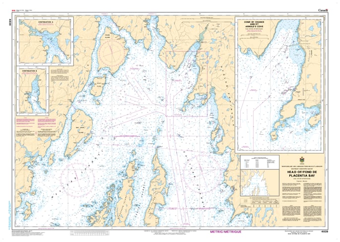
The Canadian Hydrographic Service (CHS) Chart 4839 is an official, high-precision marine navigation chart engineered for commercial shipping fleets, industrial transport vessels, and regional fishing operators traveling through the southeastern waters of Newfoundland. Published at a crisp, localized scale of 1:40,000, this authoritative nautical asset provides critical "ground-truth" coastal data required for safe passage planning, shallow-water maneuvering, and routing through the northernmost reaches of the Head of / Fond de Placentia Bay, including critical thoroughfares near Come By Chance and Arnold's Cove.
Detailed High-Resolution Bay Mapping: Delivers continuous, intricate charting across the heavily industrial and ecologically sensitive upper reaches of Placentia Bay, highlighting critical channels, island setups, and port approaches.
Official Bathymetric & Seafloor Data: Packed with precise localized depth soundings, undersea contour lines, low-tide marine benchmarks, and subarctic reef indicators essential for managing safe draft clearance and secure anchoring.
Essential Aids to Navigation: Explicitly details all official maritime buoys, powerful coastal light stations, fog signals, daybeacons, and prominent land topography to ensure high-visibility situational awareness during heavy Atlantic fog or night transits.
Premium Multi-Light Legibility: Printed with vibrant, high-contrast marine inks specifically engineered to maintain absolute clarity under both direct pilot house sunlight and dim red-light night-deck setups.
Legal Vessel Compliance: Fully satisfies international SOLAS (Safety of Life at Sea) carriage regulations and Canada Shipping Act mandates for commercial and recreational vessels requiring official hydrographic documentation.