QUESTIONS? CALL OR TEXT! 1 (877) 921-6277 or (403) 266-2241
WE SHIP EVERYWHERE!


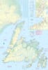
Embark on an unforgettable journey through Canada’s easternmost frontier. Our premium, double-sided travel map is the most comprehensive navigation tool for the rugged coasts of Newfoundland and the wild, remote expanses of Labrador. Whether you’re chasing icebergs, hiking UNESCO sites, or exploring historic outports, this map ensures you never miss a hidden gem.
Navigating the province’s most iconic hubs has never been easier. This edition features high-detail inset maps of:
St. John’s: Navigate the colorful "Jelly Bean Row" houses, the lively arts scene, and find the best routes to Signal Hill for panoramic harbor views.
Conception Bay: Perfect for scenic coastal drives and discovering quaint fishing villages steeped in maritime history.
Unique to this map is the inclusion of the nearby French territory, St. Pierre et Miquelon. Plan your ferry crossing and explore these charming islands with dedicated cartography that covers both the European-style streets of St. Pierre and the natural beauty of Miquelon.
The Island: Expertly marked routes through Gros Morne National Park, including the dramatic fjords and the ancient geological wonders of the Tablelands.
The Big Land: Venture into Labrador’s vast wilderness. Our map highlights the Torngat Mountains National Park, detailing the majestic fjords, glaciers, and areas rich in Arctic wildlife and Indigenous Innu and Inuit heritage.
Double-Sided Durability: Printed for heavy use during long road trips.
Comprehensive Legend: Includes provincial parks, historic sites, ferry terminals, and scenic viewpoints.
Off-Grid Reliability: Essential for Labrador’s remote frontiers where digital GPS signals often fail.
| Feature | Travel Utility |
| Double-Sided Detail | Full coverage of both Newfoundland and Labrador regions. |
| City Insets | Dedicated street-level maps for St. John's and Conception Bay. |
| International Scope | Includes the French islands of St. Pierre et Miquelon. |
| Nature Focus | Clearly marked boundaries for Gros Morne and Torngat Mountains NPs. |
| Culture & History | Historic sites, museums, and Indigenous cultural landmarks. |