QUESTIONS? CALL OR TEXT! 1 (877) 921-6277 or (403) 266-2241
WE SHIP EVERYWHERE!


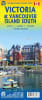
The Ultimate Island Navigator: Victoria & Southern Vancouver Island Travel Map
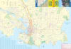
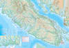
Embark on your West Coast adventure with the most comprehensive Victoria and Southern Vancouver Island Travel Map. Whether you are exploring the historic streets of the capital city or trekking through the rugged wilderness of the Pacific Rim, this double-sided, high-detail topographic map is your essential companion for all things outdoors.
Designed for hikers and mountaineers, this map provides industry-leading relief detail:
Mountain Mastery: Clearly labels all major peaks and ranges across the South Island.
Contour Accuracy: Features contour intervals of 300 metres (approx. 1,000 feet), allowing for precise navigation and elevation gain planning.
Signal-Independent: In the remote reaches of the Juan de Fuca Marine Trail or East Sooke Park, where GPS is unreliable, this physical map ensures you stay on track.
This map goes beyond simple roads to include thousands of points of interest for every type of traveler:
Summer Fun: Locate the best hidden beaches, secluded hot springs, and coastal paddling routes.
Winter Sports: Includes detailed markers for downhill ski slopes and cross-country winter recreation areas.
Outdoor Activities: Discover world-class hiking trails, mountain biking networks, and panoramic viewpoints overlooking the Salish Sea.
Vancouver Island is famous for its sudden coastal mists and rainforest downpours.
Waterproof & Tear-Resistant: Printed on advanced synthetic paper that thrives in extreme humidity and rain.
Durable: Built to withstand constant folding and unfolding during multi-day backpacking trips.