QUESTIONS? CALL OR TEXT! 1 (877) 921-6277 or (403) 266-2241
WE SHIP EVERYWHERE!



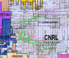
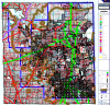
Equip your executive boardroom, land department, or corporate strategy team with the ultimate geospatial reference tool: the Complete Alberta Oil Sands Laminated Wall Map Bundle. This comprehensive 5-map collection unifies regional macro-perspectives with detailed, basin-specific lease coverage across Alberta's three major bitumen deposits—Athabasca, Cold Lake, and Peace River.
Offering over $2,500 in standalone value, this package combines the high-level Athabasca, Cold Lake & Wabiskaw Regional Map with four high-density operational wall maps: Athabasca East, Athabasca West, Peace River, and Cold Lake. Custom-printed and updated at the time of order, every map in this bundle delivers real-time corporate tenure data, midstream infrastructure layouts, and regulatory boundaries across Western Canada's energy sector.
5 High-Impact Laminated Maps Included:
Athabasca, Cold Lake & Wabiskaw Regional Map: Macro view of major operators, deposits, and takeaway infrastructure.
Athabasca East Oil Sands Map: Focuses on surface mineable and in-situ leases east of Fort McMurray.
Athabasca West Oil Sands Map: Covers western Athabasca corridors toward Wabasca and Birch Mountain.
Peace River Oil Sands Map: Captures deep in-situ thermal holdings across Northwestern Alberta.
Cold Lake Oil Sands Map: Detailed coverage of Eastern Alberta’s heavy oil and thermal recovery fairways.
Detailed Parcel Metadata: Every detailed map displays company land positions, broker-held leases, joint ventures, sale dates, lease expiry dates, price per hectare, and specific geological formation rights.
Full Midstream Integration: Maps active and proposed oil, gas, and diluent pipelines, rail corridors, roads, upgraders, refineries, terminals, and active/abandoned well sites.
Geospatial & Regulatory Precision: Built on the Dominion Land Survey (DLS) township grid down to the section level, incorporating official regulator-defined Oil Sands Area boundaries and geological formation extents.
Boardroom-Ready Lamination: Encapsulated in heavy-duty lamination for long-term durability and dry-erase marker compatibility during strategic planning sessions.
Whether conducting competitive land analysis, preparing investor presentations, or evaluating asset acquisitions, this 5-map bundle provides an unmatched spatial foundation.