QUESTIONS? CALL OR TEXT! 1 (877) 921-6277 or (403) 266-2241
WE SHIP EVERYWHERE!

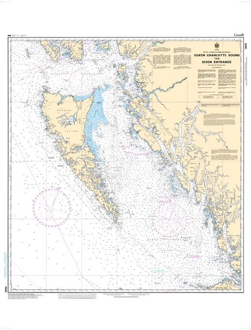
The Canadian Hydrographic Service (CHS) Chart 3012 (formerly Chart 3002) is the official, high-precision regional sailing chart designed for commercial ships, fishing fleets, expedition cruisers, and serious recreational mariners. Published at a broad scale of 1:700,000, this foundational maritime document provides the high-level transit and offshore passage planning data required to safely navigate the rugged and demanding waters of Northern British Columbia, from the open reaches of Queen Charlotte Sound up to the strategic boundary of the Dixon Entrance.
Strategic Inside Passage Overview: Delivers the comprehensive "big picture" perspective essential for blue-water navigation, coastal route planning, and tracking deep-sea approaches along the outer waters of Haida Gwaii.
Complete Regional Cartography: Features the complete configuration of the northern BC shoreline, explicitly mapping Graham Island, Moresby Island, Hecate Strait, and the complex network of sounds leading into the Great Bear Rainforest.
Official Bathymetric Details: Packed with critical depth soundings, undersea contour lines, and localized seafloor characteristics to ensure total situational awareness in heavy swells or restricted visibility.
Safety & Navigation Aids: Clearly isolates primary aids to navigation, major marine hazards, land elevations, and coastal landmarks, facilitating a safe transition from the high seas to detailed harbor approach charts.
Legal Vessel Compliance: Fully meets standard SOLAS (Safety of Life at Sea) carriage regulations and the Canada Shipping Act requirements for vessels mandating official hydrographic documentation.