QUESTIONS? CALL OR TEXT! 1 (877) 921-6277 or (403) 266-2241
WE SHIP EVERYWHERE!

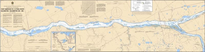
The Canadian Hydrographic Service (CHS) Chart 6410 is an official, government-authorized river navigation chart designed for commercial barge operators, tugboat captains, northern shipping networks, and wilderness paddlers. This critical hydrographic map details Kilometres 330 to 390 of the Mackenzie River system, covering the key marine transit corridor from Fort Simpson (Lı́ı́dlıı́ Kų́ę́) to the Trail River in Canada's Northwest Territories.
Mackenzie River Corridor Charting: Provides highly accurate, continuous coverage of the river navigation channel, islands, and shifting sandbars between Fort Simpson and the Trail River confluence.
Official Riverine Bathymetry: Packed with localized depth soundings, channel flow markers, low-water datum references, and crucial warnings for gravel bars, fast-moving currents, and shallow shoals.
Essential Aids to Navigation: Explicitly details official Canadian Coast Guard river buoys, range lights, daymarks, compass roses, and key shoreline landmark references for accurate pilotage.
High-Contrast Multi-Light Legibility: Printed using vibrant, durable marine inks designed to maintain perfect readability under bright northern summer daylight or dim red-light wheelhouse conditions.
Official Marine Compliance: Fully satisfies mandatory vessel carriage regulations and Canada Shipping Act requirements for commercial transport, logistics, and resource operations requiring approved hydrographic documentation.