QUESTIONS? CALL OR TEXT! 1 (877) 921-6277 or (403) 266-2241
WE SHIP EVERYWHERE!

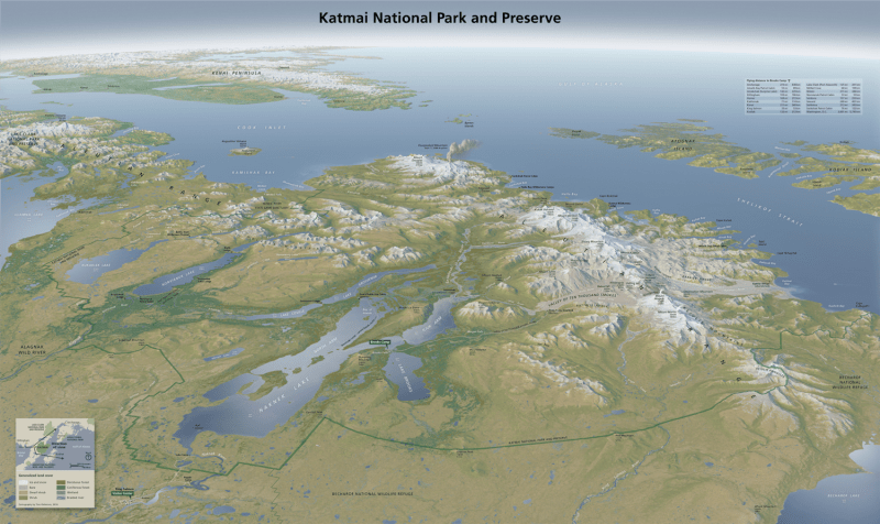
Discover the raw, volcanic power and sprawling wilderness of the Alaska Peninsula with the Katmai National Park and Preserve Wall Map. Measuring 30x18 inches, this high-definition map provides an immersive look at one of the most dynamic landscapes in the National Park system. Famous as the home of the world-dense population of brown bears and the site of the largest volcanic eruption of the 20th century, Katmai is a land of fire, ice, and abundant life.
The map features exquisite shaded relief that highlights the rugged Aleutian Range and the centerpiece of the park: the Valley of Ten Thousand Smokes. Every major geographical feature is meticulously detailed, from the turquoise waters of Naknek Lake and Brooks Camp to the ash-filled basins and steaming vents of Novarupta and Mount Katmai. Detailed cartography tracks the intricate coastline of the Shelikof Strait, including the remote bays and coastal cliffs where the mountains meet the sea. Whether you are a backcountry hiker planning a trek through the volcanic ash, an angler dreaming of the world-class trout in the Brooks River, or a conservationist, this official-style wall map is the definitive visual record of this sub-arctic sanctuary.