Olympic National Park encompasses four distinctly different ecosystems in its nearly one million acres. National Geographic’s Trails Illustrated map of Olympic National Park offers outdoors enthusiasts a valuable tool for exploring the park’s old-growth forests, glaciers, untamed rivers, and rugged coastline. Expertly researched and created in partnership with local land management agencies, this map features key areas of interest including Mount Olympus, Ozette Lake, Olympic National Forest, Lake Quinalt, Mount Skokomish Wilderness, Hurricane Ridge, Lake Crescent, and more.
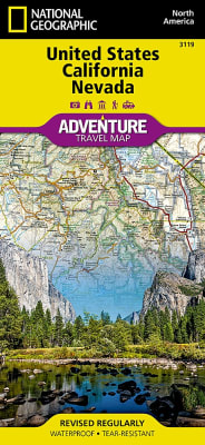
There are few nations as vast and spectacularly diverse as the United States of America. From the Atlantic to the Pacific, "America the Beautiful" offers boundless destinations and experiences for travelers seeking outdoor adventures, small town delights, or the excitement of urban culture.
There are few nations as vast and spectacularly diverse as the United States of America. From the Atlantic to the Pacific, “America the Beautiful” offers boundless destinations and experiences for travelers seeking outdoor adventures, small town delights, or the excitement of urban culture.
Colorado has the highest mean elevation of any state in the United States. It’s home to 58 mountain peaks higher than 14,000 feet—more than any other state in the U.S—making it a mountain sports mecca. “Bagging” these fourteeners is a goal for many Coloradans and visitors to the state—and for some, it’s an obsession.
Colorado has the highest mean elevation of any state in the United States. It’s home to 58 mountain peaks higher than 14,000 feet—more than any other state in the U.S—making it a mountain sports mecca. “Bagging” these fourteeners is a goal for many Coloradans and visitors to the state—and for some, it’s an obsession.
National Geographic's Alaska AdventureMap is designed to meet the unique needs of adventure travelers with its durability and detailed, accurate information. The map includes the accurate locations of all cities and towns with a user-friendly index, plus a clearly marked road network complete with distances and designations for major highways, main roads, plus tracks and trails for those seeking to explore more remote parts of the Islands.
National Geographic's Trails Illustrated map of Angeles National Forest is a two-sided, waterproof map designed to meet the needs of outdoor enthusiasts with unmatched durability and detail. This map was created in conjunction with local land management agencies and is loaded with valuable recreation information.
Capitol Reef National Park is a hidden gem located in the Waterpocket Fold, a wrinkle in the earth that extends nearly 100 miles through south-central Utah’s red rock country. National Geographic’s Trails Illustrated map of Capitol Reef provides unmatched detail of the park to meet the needs of amateur and experienced outdoor enthusiasts alike. Created in partnership with local land management agencies, this expertly researched map features the entire park as well as adjacent areas of interest including Anasazi State Park and portions of Fishlake National Forest, Grand Staircase-Escalante National Monument, and Dixie National Forest.
National Geographic's Trail Illustrated map of Flat Tops South offers unparalleled detail for outdoor enthusiasts looking to explore this area of Colorado, regardless of the season. Expertly researched and created in partnership with the U.S. Forest Service, Bureau of Land Management and others, this map features key points of interest, including White River National Forest, Flat Tops Wilderness, Hardscrabble and Gypsum Hills Recreation Areas, Rifle Falls and Rifle Gap State Parks, Glenwood Canyon plus the Colorado and Eagle Rivers.
National Geographic’s Trails Illustrated map of Flat Tops North in Colorado is designed to meet the needs of outdoor enthusiasts with unmatched durability and detail. Expertly researched and created in partnership with local land management agencies, this map features key points of interest including Trappers Lake, Meeker, the Flat Tops Trail Scenic Byway, Flat Tops Wilderness area and the Oak Ridge State Wildlife Area.
National Geographic's Canada East AdventureMap is designed to meet the needs of adventure travelers with its durability and detailed, accurate information. The map includes the locations of cities and towns with a user-friendly index, a clearly marked road network complete with distances and designations for roads/highways, plus secondary routes for those seeking to explore the stark wilderness of Newfoundland, the fertile farms of Prince Edward Island, or Nova Scotia's hidden coves and beaches.
National Geographic's United Kingdom AdventureMap is designed to meet the needs of adventure travelers with its durability and detailed, accurate information. This map includes the locations of cities and towns with a user-friendly index, a clearly marked road network complete with distances and designations for roads/highways, plus secondary routes for those seeking to explore off the beaten path.
National Geographic's Alps AdventureMap is designed to meet the unique needs of adventure travelers with its durability and accurate information. This folded map provides global travelers with the perfect combination of detail and perspective, highlighting hundreds of points of interest and the diverse and unique destinations within the region.
National Geographic's Switzerland AdventureMap is designed to meet the unique needs of adventure travelers with its durability and accurate information. This folded map provides global travelers with the perfect combination of detail and perspective, highlighting hundreds of points of interest and the diverse and unique destinations within the country.
Slovakia's snow-capped mountains and lush valleys making up almost a third of its area – a great place for adventure whether you are on a solo holiday, travelling with a partner, or with a family group. National Geographic's Slovakia AdventureMap is designed to meet the needs of all adventure travelers with its durability and detailed, accurate information. The map includes the locations of cities and towns with a user-friendly index, a clearly marked road network complete with distances and designations for roads/highways, plus secondary routes for those seeking to explore off the beaten path.
National Geographic's Czech Republic AdventureMap is designed to meet the unique needs of adventure travelers with its durability and accurate information. This folded map provides global travelers with the perfect combination of detail and perspective, highlighting hundreds of points of interest and the diverse and unique destinations within the country.
The front side is an easy-to-read road map with insets of: - Asheville - Charlotte - Winston / Salem / Greensboro - Fayetteville - Wilmington - Western North Carolina The back includes: - Map and information for Raleigh / Durham - Information on Great Smoky Mountain National Park - Points of interest - Scenic drive - Park Service sites in North Carolina.
The front side is an easy-to-read road map with insets of: - Athens - Augusta - Albany - Savannah - Brunswick / Jekyll Island - Columbus - Macon The back includes: - Points of interest - Information and map of Atlanta - Information for Okefenokee National Wildlife Refuge and Swamp Park - Scenic drive - Park Service sites in Georgia.
The front side is an easy-to-read road map with insets of: - Lowell - Downtown Boston - Worcester - Springfield - Providence, RI - New Bedford / Fall River The back includes: - Map and information for Boston - Information for Cap Cod National Seashore - Points of interest - Scenic drive - Park Service sites in Massachusetts
National Geographic's Crete AdventureMap is designed to meet the unique needs of adventure travelers with its durability and accurate information. This folded map provides global travelers with the perfect combination of detail and perspective, highlighting hundreds of points of interest and the diverse and unique destinations within the country.
National Geographic’s Trails Illustrated map of the Old Faithful area of Yellowstone National Park is designed to meet the needs of visitors with unmatched detail of the upper and midway geyser sections of the national park. Expertly researched and created in partnership with local land management agencies, this map features key points of interest including the Old Faithful geyser area, Midway Geyser Basin, Old Faithful, and Fountain Paint Pots. A list of recommend day hikes includes distances and difficulties. The Continental Divide Trail passes through this map.
National Geographic's Corsica AdventureMap is designed to meet the unique needs of adventure travelers with its durability and accurate information. This folded map provides global travelers with the perfect combination of detail and perspective, highlighting hundreds of points of interest and the diverse and unique destinations within the country.
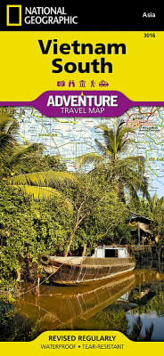
National Geographic's Vietnam, South AdventureMap is designed to meet the unique needs of adventure travelers with its durability and accurate information. This folded map provides global travelers with the perfect combination of detail and perspective, highlighting hundreds of points of interest and the diverse and unique destinations within the country.
National Geographic's Greece AdventureMap is designed to meet the unique needs of adventure travelers with its durability and accurate information. This folded map provides global travelers with the perfect combination of detail and perspective, highlighting hundreds of points of interest and the diverse and unique destinations within the country.
National Geographic's Ecuador and Galapagos Islands AdventureMap is designed to meet the unique needs of adventure travelers with its durability and accurate information. This folded map provides global travelers with the perfect combination of detail and perspective, highlighting hundreds of points of interest and the diverse and unique destinations within the country.
National Geographic's Chile AdventureMap is designed to meet the unique needs of adventure travelers with its durability and accurate information. This folded map provides global travelers with the perfect combination of detail and perspective, highlighting hundreds of points of interest and the diverse and unique destinations within the country.
National Geographic's Germany AdventureMap is designed to meet the unique needs of adventure travelers with its durability and accurate information. This folded map provides global travelers with the perfect combination of detail and perspective, highlighting hundreds of points of interest and the diverse and unique destinations within the country.
National Geographic's Sicily AdventureMap is designed to meet the unique needs of adventure travelers with its durability and accurate information. This folded map provides global travelers with the perfect combination of detail and perspective, highlighting hundreds of points of interest and the diverse and unique destinations within the country.
National Geographic's Spain and Portugal AdventureMap is designed to meet the unique needs of adventure travelers with its durability and accurate information. This folded map provides global travelers with the perfect combination of detail and perspective, highlighting hundreds of points of interest and the diverse and unique destinations within the country.
National Geographic's Italy AdventureMap is designed to meet the unique needs of adventure travelers with its durability and accurate information. This folded map provides global travelers with the perfect combination of detail and perspective, highlighting hundreds of points of interest and the diverse and unique destinations within the country.
National Geographic's Ireland AdventureMap is designed to meet the unique needs of adventure travelers with its durability and accurate information. This folded map provides global travelers with the perfect combination of detail and perspective, highlighting hundreds of points of interest and the diverse and unique destinations within the country.
National Geographic's Mexico AdventureMap is designed to meet the unique needs of adventure travelers with its durability and accurate information. This folded map provides global travelers with the perfect combination of detail and perspective, highlighting hundreds of points of interest and the diverse and unique destinations within the country.
National Geographic's Puerto Rico AdventureMap is designed to meet the unique needs of adventure travelers, highlighting hundreds of points of interest and the diverse and unique destinations within the country.
National Geographic's Baja California, South, Mexico AdventureMap is designed to meet the unique needs of adventure travelers, highlighting hundreds of points of interest and the diverse and unique destinations within the country.
National Geographic's Baja California North, Mexico AdventureMap is designed to meet the unique needs of adventure travelers, highlighting hundreds of points of interest and the diverse and unique destinations within the country.
National Geographic's Costa Rica AdventureMap is designed to meet the unique needs of adventure travelers, highlighting hundreds of points of interest and the diverse and unique destinations within the country.
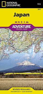
National Geographic's Japan AdventureMap is designed to meet the unique needs of adventure travelers with its durability and accurate information. This folded map provides global travelers with the perfect combination of detail and perspective, highlighting hundreds of points of interest and the diverse and unique destinations within the country.
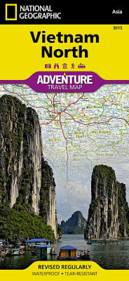
National Geographic's Vietnam, North AdventureMap is designed to meet the unique needs of adventure travelers with its durability and accurate information. This folded map provides global travelers with the perfect combination of detail and perspective, highlighting hundreds of points of interest and the diverse and unique destinations within the country.
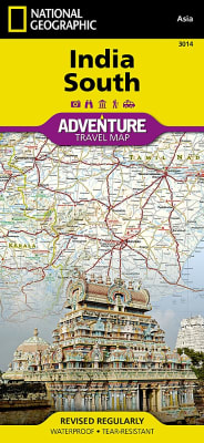
National Geographic's India, South AdventureMap is designed to meet the unique needs of adventure travelers with its durability and accurate information. This folded map provides global travelers with the perfect combination of detail and perspective, highlighting hundreds of points of interest and the diverse and unique destinations within the country.
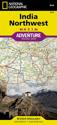
National Geographic's India, Northwest AdventureMap is designed to meet the unique needs of adventure travelers with its durability and accurate information. This folded map provides global travelers with the perfect combination of detail and perspective, highlighting hundreds of points of interest and the diverse and unique destinations within the country.
National Geographic's India, Northeast AdventureMap is designed to meet the unique needs of adventure travelers with its durability and accurate information. This folded map provides global travelers with the perfect combination of detail and perspective, highlighting hundreds of points of interest and the diverse and unique destinations within the country.
National Geographic's China, East AdventureMap is designed to meet the unique needs of adventure travelers with its durability and accurate information. This folded map provides global travelers with the perfect combination of detail and perspective, highlighting hundreds of points of interest and the diverse and unique destinations within the country.
National Geographic's Thailand AdventureMap is designed to meet the unique needs of adventure travelers with its durability and accurate information. This folded map provides global travelers with the perfect combination of detail and perspective, highlighting hundreds of points of interest and the diverse and unique destinations within the country.
National Geographic's Langtang, Nepal AdventureMap is designed to meet the unique needs of adventure travelers with its durability and accurate information. This folded map provides global travelers with the perfect combination of detail and perspective, highlighting hundreds of points of interest and the diverse and unique destinations within the country.
National Geographic's Annapurna, Nepal AdventureMap is designed to meet the unique needs of adventure travelers, highlighting hundreds of points of interest and the diverse and unique destinations within the country.
National Geographic's Everest Base Camp AdventureMap is designed to meet the unique needs of adventure travelers, highlighting hundreds of points of interest and the diverse and unique destinations within the country.
National Geographic's Nepal AdventureMap is the most authoritative map for touring the country. Each waterproof and tear-resistant map provides travelers with the perfect combination of detail and perspective, highlighting points of interest for those venturing outside city centers.
National Geographic's Trails Illustrated map of Jasper South is a two-sided, waterproof map designed to meet the needs of outdoor enthusiasts with unmatched durability and detail. This map was created in conjunction with local land management agencies and is loaded with valuable recreation information.
National Geographic's Trails Illustrated map of Banff North is a two-sided, waterproof map designed to meet the needs of outdoor enthusiasts with unmatched durability and detail. This map was created in conjunction with local land management agencies and is loaded with valuable recreation information.
National Geographic's Trails Illustrated map of Banff South is a two-sided, waterproof map designed to meet the needs of outdoor enthusiasts with unmatched durability and detail. This map was created in conjunction with local land management agencies and is loaded with valuable recreation information.
National Geographic's Flagstaff and Sedona Trails Illustrated topographic map is the most comprehensive available for outdoor enthusiasts of all types. Designed to be easy-to-read, yet highly detailed – this map includes a comprehensive road and trail network distinguishing between major, secondary, high-clearance, OHV routes, hiking, horse, biking, multi-use, motorized and non-motorized trails. All forest roads are labeled with their official road number and trails are clearly identified with their given name. Boundaries are color-coded and clearly shown for National Forest, National Monument, Ranger Districts, Wilderness Areas, State Park, State Wildlife Areas, Department of Defense, and Indian Reservation lands. Additionally, Arizona Game Management Unit (GMU) boundaries and public and private lands are clearly identified.
One of five new Trails Illustrated maps for the Washington Cascades region offering the most detailed and up-to-date map for the forest, carefully researched and developed in co-operation with local land managers and agencies. Each map contains easy to read trails, numbered forest service roads, campsites, access points, scenic points-of-interests, and important facilities.
One of five new Trails Illustrated maps for the Washington Cascades region offering the most detailed and up-to-date map for the forest, carefully researched and developed in co-operation with local land managers and agencies. Each map contains easy to read trails, numbered forest service roads, campsites, access points, scenic points-of-interests, and important facilities.
The magnificent Multnomah Falls is just one of many natural, cultural, and recreational attractions in the Columbia River Gorge Scenic Area. The 80-mile-long gorge contains diverse ecosystems ranging from the lush Oneonta Gorge Rain Forest to the arid Celilo Grasslands. Expertly researched and created in partnership with local land management agencies, National Geographic’s Trails Illustrated map of Columbia River Gorge provides an unparalleled tool for exploring this breathtaking region. Some of the key areas of interest featured on the map include the White Salmon, Klickitat, Sandy, and Lower Deschutes rivers; Yacolt Burn State Forest; Maryhill, Columbia Hills, and Rooster Rock state parks; Mark O. Hatfield Wilderness; and portions of Mount Hood and Gifford-Pinchot national forests.
Located just outside of Portland, Mt. Hood is the tallest peak in Oregon, the fourth highest in the Cascade Range, and a premier destination for outdoor enthusiasts. The mountain has six ski areas, the renowned Timberline Lodge located on the southern flank beside the Palmer Glacier, and is part of the 1.0M acre Mt. Hood National Forest.